
Managing Traffic and Movement
We know traffic, congestion and road capacity are significant local concerns. People told us that congestion is not just inconvenient, but affects daily journeys, access to services and how local businesses operate.
In response, movement has been placed at the centre of the emerging masterplan. The proposals are being developed to make walking, cycling and public transport practical choices for everyday journeys, including routes and footpaths to local centres, schools, green spaces and bus stops.
The map below shows how walking, cycling and public transport could connect through the site and into surrounding areas. Our aim is to support easier east-west movement across this part of Southend, helping new residents make local journeys without always needing to rely on existing roads.
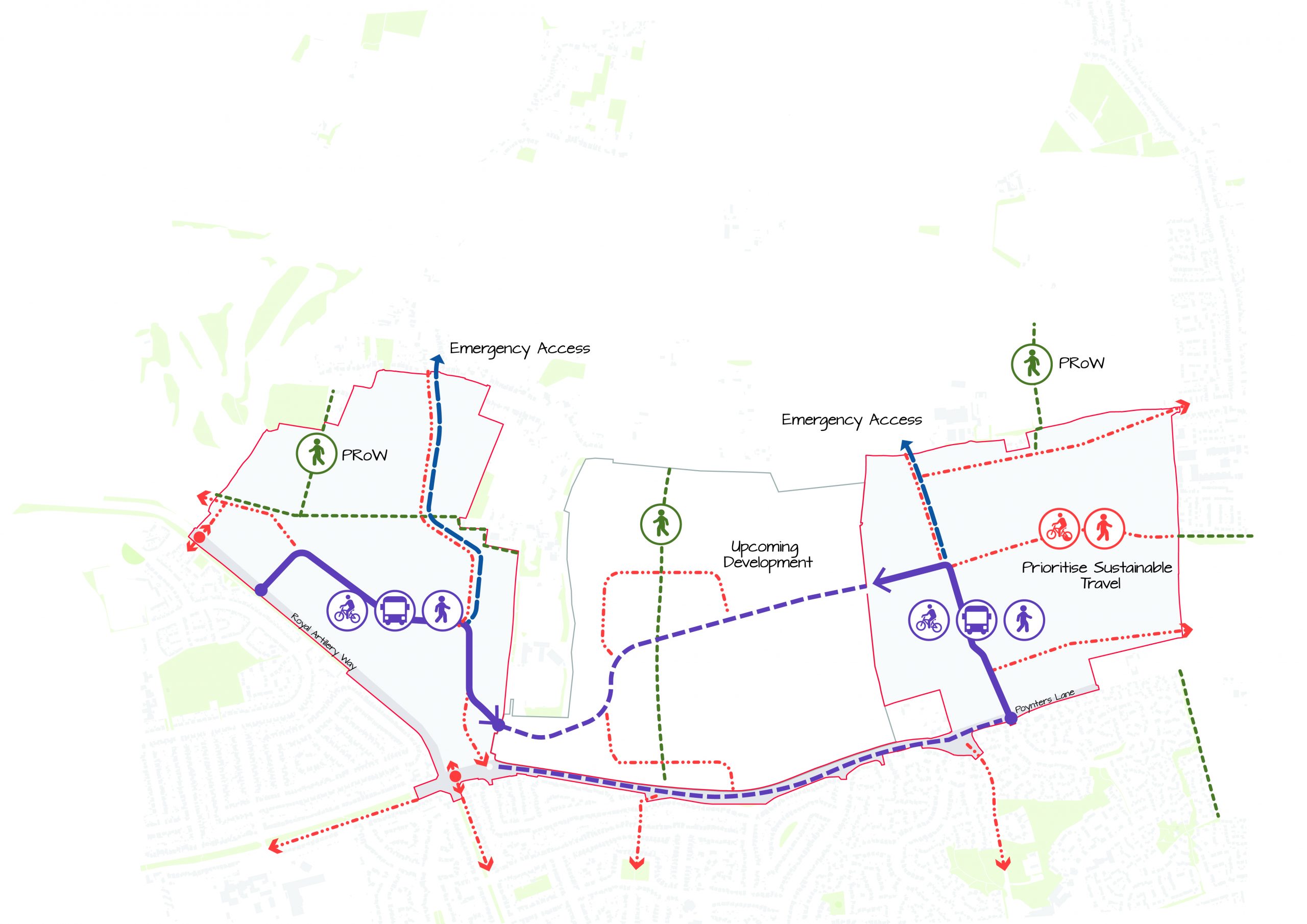
Access and Movement Strategy
We know that some journeys will still need to be made by car, including trips into town and elsewhere. That is why we are also looking at wider transport improvements, including discussions with local bus operators about how our plans can align with their future ambitions, ways to practically encourage uptake of different forms of transport like cycling or walking, and upgrades to key junctions south of the site.
Our emerging strategy will continue to be tested through traffic modelling, safety work and the planning process, including how the site connects to the wider road network. Vehicle access at the northern points of the site will be restricted to use of the emergency services, only.